We’ve been doing a lot of thinking lately about utility—specifically, what makes this platform useful to different parts of the industry.

Mineralocity January Newsletter 2026
The new Mineralocity is here. We have split the platform into two powerful interfaces to help you move faster:

Mineralocity November Newsletter 2025
Finding qualified leads and understanding your true market is the key to growing your business. We built Mineralocity to be your one-stop shop for exactly that—showing you where your potential customers are, what they’re mining, and the most efficient way to reach them.

Mineralocity October Newsletter 2025
We’re excited to announce a major renovation of the Mineralocity platform, based directly on your feedback. We are adding powerful new data, more intuitive features, and new ways for your team to collaborate.
Mineralocity August Newsletter 2025
Looking at the current landscape, it’s clear we’re in the midst of one of the most dynamic periods of consolidation our industry has ever seen. With over 50 significant M&A deals in the first half of 2025 alone, this surge is being fueled by a historic wave of federal infrastructure investment and a tech-driven boom in AI and data center construction.

Mineralocity June Newsletter 2025
The era of AI is upon us, and we’re using it. While we’re seeing incredible value in integrating AI into our everyday work, we also understand the importance of real people and real-life education and experiences.
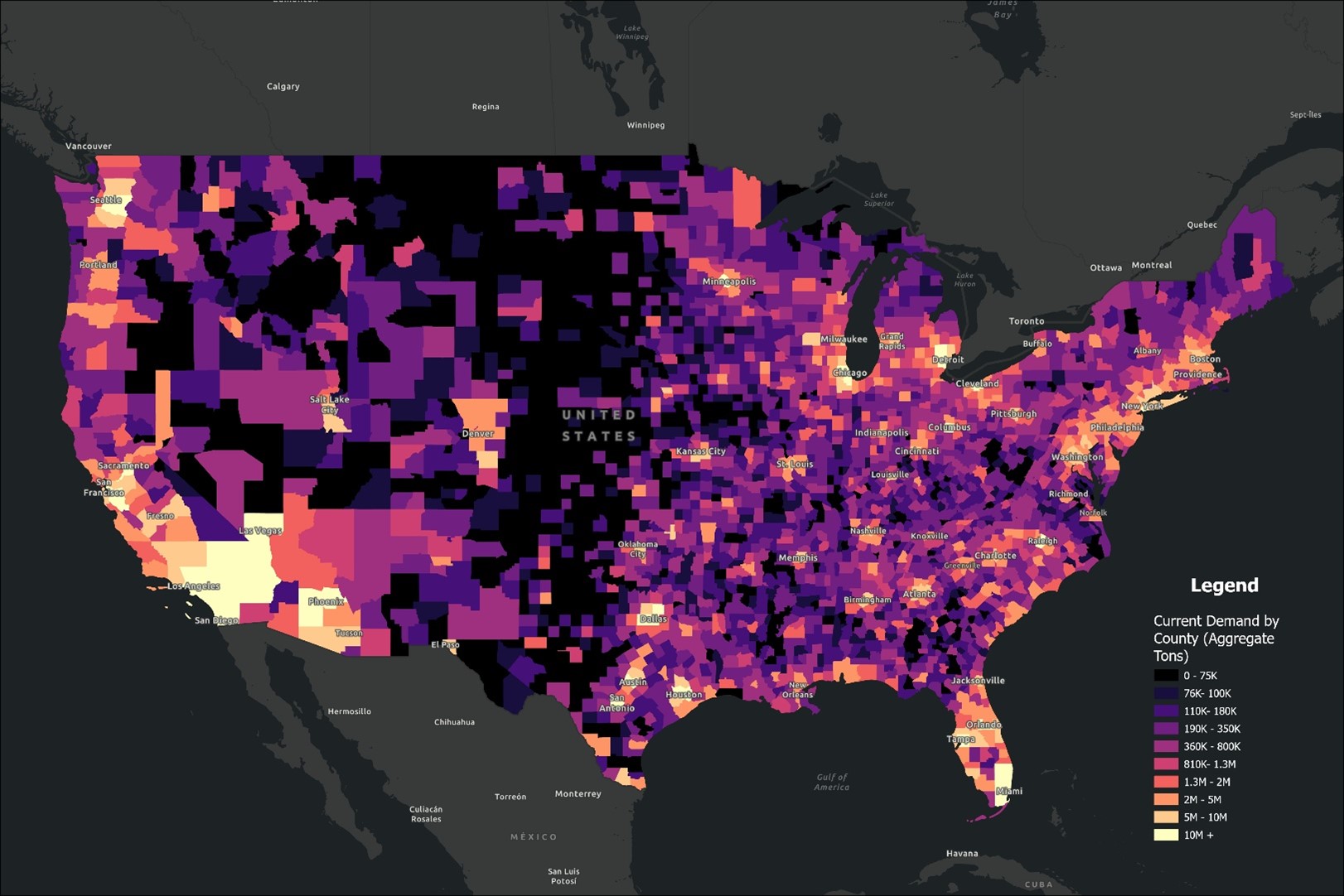
Top 25 U.S. Counties by Estimated Current Aggregate Demand
Explore the top 25 U.S. counties by estimated aggregate demand in 2024. Learn how construction trends, infrastructure investments, and population growth are driving demand for aggregates across key regions.

Mineralocity April Newsletter 2025
As we continue to develop and refine the Mineralocity platform, we’re excited to share the powerful capabilities it offers for both greenfield exploration and high-level market research. Whether you’re looking to gain insight into a new area for mineral discovery or analyze broader market trends, Mineralocity is the tool to help you make data-driven decisions with ease.

Unlocking Smart Decisions: How Data Analytics and Market Insights Transform Construction Aggregate Exploration
Explore how data analytics and market analysis enhance decision-making in construction aggregate exploration. Learn how integrating geospatial data, market trends, and production insights can optimize site selection and strategic planning.
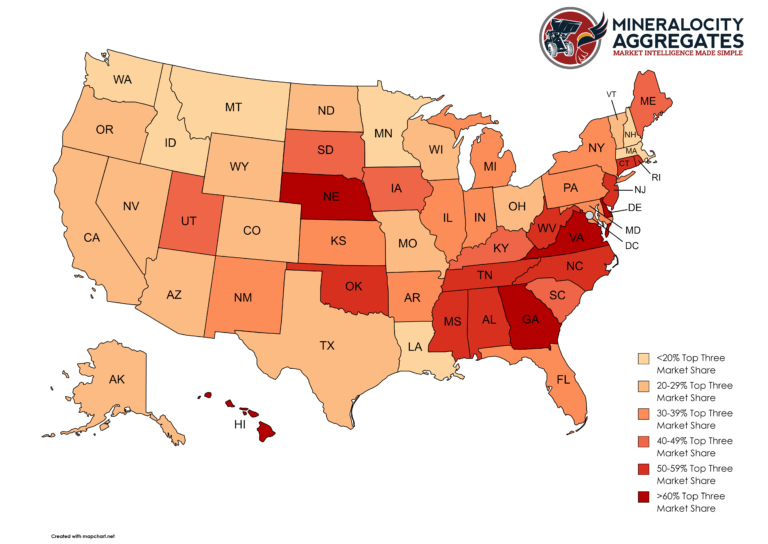
The Dynamics of Market Concentration in the Construction Aggregate Industry